WHERE CAN I GO DETECTING GOLD IN QUEENSLAND ?
(Updated June 2024)
Now that’s a great question ! …. that we often get asked by customers/visitors to our store.
To lawfully go detecting gold nuggets (and gold specimens) in Queensland you require a Queensland ‘Fossicking Licence’.
Unfortunately, 'Miners Rights' issued in other States (like W.A. and Victoria) do not apply in Queensland.
You can purchase your Qld Fossicking Licence online using a credit card payment. Costs vary from about $10 for 1 month, up to about $60 for 1 year for an individual fossicker (A one-year Fossicking Licence for a family costs about $80). Your licence is e-mailed to you once payment is confirmed.
Fossicking Laws/Responsibilities
The Queensland Fossicking Act 1994 and it’s associated Regulations contain requirements for fossickers to maintain safety, hygiene and a high standard of behaviour. Infringement notices (on-the-spot fines) and prosecutions may be used to enforce the provisions of the legislation. Breaches may also result in cancellation of licences.
When fossicking in Queensland, some of the general responsibilities include that a person MUST NOT:
• destroy or injure any trees
• clear any vegetation except above an actual excavation
• pollute any watercourse, dam or the like
• create areas likely to erode
• interfere with any livestock, wildlife or property infrastructure (e.g. windmills, bores, pumps, tanks, fences)
• interfere with any heritage or cultural site
• undermine any banks or dig pits to create any tunnels or overhanging sections.
There are also other requirements a person must follow when fossicking near watercourses, and also upon designated fossicking lands and areas.
When fossicking upon private property in Queensland, a person should also have written permission from the land owner/s.
A Qld Fossicking Licence allows you to search for, and collect fossicking materials using hand tools and for recreational, tourist and educational purposes only.
“Hand tools such as picks, shovels, hammers, sieves, shakers, electronic detectors (metal detectors) and other similar tools can be used.
No machinery is permitted. This includes water sluices with electronic pumps and dredges of any kind.
You can collect from the surface or by digging, but you are not permitted to dig below 2m of the natural ground surface of land or below 0.5m in streams. Overhangs and tunnels are not allowed.”
Also - “You can collect gemstones, ornamental stones, mineral specimens, alluvial gold (including nuggets) and some fossil specimens, but not meteorites and fossils of vertebrate animals. (The finding/ownership of meteorites in Australia will be considered in a future BLOG article).
You don’t need a fossicking licence to search for ‘treasure’ such as lost jewellery and coins on a beach.”
In other words – you can go detecting on public beaches in Queensland in search of coins and jewellery (including those made from gold or platinum or silver) without holding a Qld Fossicking Licence.
However, if you find any item of value, including jewellery – that does not belong to you - then you are required by law to hand such property in to the police. Accordingly, you are entitled to receive an official receipt from the police for the found property you hand in to them. If the police can not locate the lawful owner of that found property within 30 days, then you can lawfully lodge a claim to the police for that property you found.
Otherwise, if you keep valuable property that you find - that does not belong to you – you may be liable to prosecution for “Stealing by Finding”.
The Qld Police Service website contains a List of Found Property (including items of jewellery) reported during the past month. This information may also be useful to someone who has lost an item and not reported it to police.
General Permission Areas (GPA's) for Fossicking in Qld
It was recently publicly reported that: "Queensland currently has 11 fossicking areas, 9 designated fossicking lands, and 21 General Permission Areas (GPA's) for fossicking - totaling more than 20,000 hectares"
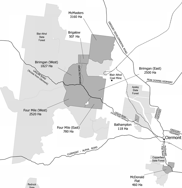
There are 11 separate General Permission Areas (GPA's) in the Clermont area where landholders have given general permission for fossicking. Seven of these are in the Clermont State Forest. More than 11,000 Hectares (> 110 square kilometres) of General Permission Areas (GPA's) are available for fossicking near Clermont (about 950km NNW of Brisbane).
A total of about 50 square kilometres of General Permission Areas (GPA's) are available for fossicking at Durikai State Forest, about 30km west of Warwick (about 200km SW of Brisbane).
Also near Warwick (about 30km NW), approximately 5 square kilometres of General Permission Areas (GPA's) are available for fossicking at Talgai State Forest.
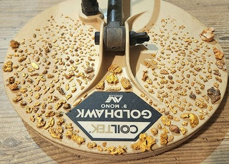
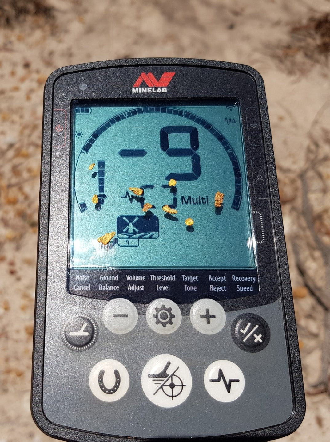
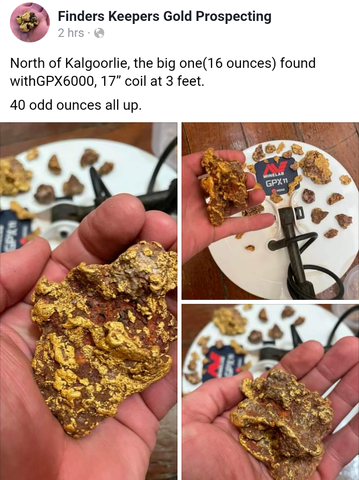
We regularly receive feedback (including photos) from customers, and other detectorists/prospectors, about gold nuggets being detected in the above GPA's - mostly found using Minelab Pulse-Induction (PI) technology detectors (e.g. GPZ 7000, GPX 6000, GPX 5000/4500, and SDC 2300).
As at 24 June 2024 -
A new 507-hectare fossicking area - the Brigalow General Permission Area (GPA) - is now available in Blair Athol State Forest near Clermont.
New GPA's Sought
In late 2022 it was reported that "the Rockhampton Regional Council said it had written to the Department of Resources to try to create GPA's in three locations in Mount Morgan."
Like the 'Amalgamated Prospectors & Leaseholders Association' (APLA) of Western Australia, and also the 'Prospectors and Miners Association of Victoria' (PMAV) - perhaps what is required in Queensland is a similar membership-based body created to protect the rights and opportunities of those who wish to fossick and prospect in Queensland. Furthermore, such an Association could lobby the Queensland Government on behalf of it's members to create more opportunities for fossicking & prospecting throughout Queensland, including far more General Permission Areas.
In other States like Western Australia and Victoria there is far more total areas of ground available for fossicking and prospecting with a Miners Right - than there is currently available via GPA's in Queensland.
Perhaps the following online information with respect to fossicking areas in Queensland, and Qld Prospecting Permits, may also be of interest to you:
Queensland 'Globe'
Queensland Globe is a free online interactive website tool that you can use to identify property names (and their boundaries) including pastoral properties.
e.g. you can select following options: All Layers > Location > Property Names
Queensland ‘GeoResGlobe’
Queensland ‘GeoResGlobe’ is another free online interactive website tool that you can use to obtain information on Queensland's mining and exploration data, including:
1. Identify property names (and their boundaries) including pastoral properties; and
2. Identify ‘Exploration Permits - Minerals’ (EPM’s) – either “Granted” (current) or “Application” (pending assessment); and
3. Identify 'Mining Leases' (ML's) -
covering areas/properties of interest to you. Additional available information includes the “Authorised Holder Name” of the EPM’s / ML's, as well as the “Grant Date” and “Expiry Date’ of them.
Upon accessing this interactive website tool, you can use the menu system on the left hand side.
Click on “Layers” > “Add Layers” > “All Layers”
Then you can choose from a list of different Layers, and also the sub-layers within each Layer (e.g. “Cadastre” > “Properties”).
Example 1 of available information - a simple search via the Qld ‘GeoResGlobe’ database revealed that: in early May 2023 an Application was lodged for a Minerals Exploration Permit (EPM 28787) covering 230 square kilometres to the west & north-west of Durikai State Forest. Interestingly, in April & May 2023 the same Applicant also lodged EPM Applications for other areas within and around Durikai State Forest.
Example 2 of available information - a simple search via the Qld ‘GeoResGlobe’ database - using the menu system on the left hand side, by Clicking on “Production permits” > “Mining lease” > “ML granted”, and then selecting the letter "i" Information tool and then clicking this tool within the marked area of ML 1870 on the map, provides further information at the bottom of the screen - which revealed that within the Blair Athol State Forest, Mining Lease ML 1870 (re: "Au" - gold) was granted in 1980 and is current until June 2026, including the name of the leaseholder.
The ‘TRILOBITE’ Solutions APP (for mobile devices)
Many prospectors in W.A. use the ‘TRILOBITE’ Solutions Application on their mobile phone or tablet.
This App provides off-line geology & exploration data covering all of Australia & New Zealand.
All Users of the “Australia Geology Travel Maps” must have the App subscription. Then the additional “WA Prospector” subscription gives access to current tenements, gold deposits, mineral exploration holes, and topographic maps in Western Australia.
Here is a link to a recent (2024) video on how to use the TRILOBITE App to find areas to target for gold prospecting.
The “QLD gold”, “NSW gold” and “VIC gold” subscriptions also give access to the gold maps for the respective States. (All of these subscriptions have a 1-week free trial period).
Some of the many great features of this App include:
• Runs on Android and Apple phones and tablets
• Maps are downloaded to your phone - so there is no dependency on mobile phone reception in the field
• Simplified & detailed geology maps for all of Australia
• Old mine workings, gold, gems & other metal finds
• Gold distribution maps
• Mining & exploration tenement information
• Data is sourced from the State geological surveys & Geoscience Australia
• Aero-magnetic imagery for all States
• Record your trail (Self-Tracking Function), so you can retrace your steps
• Mark & Record notes on important locations – choose a colour for each marker
• PENDING ground in Western Australia is shown on the mapping (also marked as a blue colour)
For the cost of only about $40 per year (for both subscriptions I needed for prospecting in W.A.), I found the ‘TRILOBITE’ App an extremely valuable tool for identifying areas with potential to find more gold.
Contacting Exploration Permit Holders/Mining Companies
During my recent several years of full-time prospecting, I contacted several gold exploration and mining companies, and after voluntarily submitting written details (via e-mail) about my prospecting experience, vehicle/s, prospecting techniques & gear (including safety equipment), my Prospecting Licence/Miner's Right, and public liability insurance etc., and my intentions – I was very fortunate to be granted written conditional permission to prospect on their leases. As a result, I provided details (photos & GPS co-ordinates) of all my finds of gold nuggets to the leaseholders, who then permitted me to explore additional ground held via their leases.
Properties Allowing Prospecting & Camping
There are several properties (including large stations) throughout Queensland that permit recreational prospecting/camping for a fee. These include locations near: Georgetown/Forsythe in North Qld, and Warwick ('Glendon Camping Ground' – which is beside Durikai State Forest) in South-East Qld, and Clermont & Mount Morgan in Central Qld, and Palmerville Station in Cape York Peninsula, etc
https://www.facebook.com/flatcreekstation/
https://www.facebook.com/people/Western-Creek-Gold/100066532061530/
https://www.gilbertongold.com/
https://glendoncamping.com.au/
https://www.facebook.com/people/Fig-Tree-Camp/100066735554908/
https://goldenprospectingtours.com.au
https://mountmorganoutdoors.com.au/product/car-lyn-fossicking-off-grid-camping-property-mount-morgan/
https://www.facebook.com/people/Palmerville-Gold/100065218831323/
The website 'Hipcamp' also features several properties that permit camping & fossicking in Queensland, including in southern Qld.
To lawfully go detecting gold nuggets (and gold specimens) on such properties - a Qld Fossicking Licence is also required.
Unallocated State Land
The Qld Government webpage for "Fossicking Rules and Responsibilities" states: "If the land is "Unallocated State Land", you don't need permission to fossick unless:
- there has been a native title determination over the land, or
- the land has been ‘vested’ in another agency and used for a particular purpose."
"Unallocated state land (USL) refers to land above and below the high-water mark (HWM) that is not freehold land or land contracted to be granted in fee simple by the state; is not a road or reserve; and is not subject to a lease, licence or permit issued by the state."
The Qld Dept of Natural Resources & Mines previously reported that:
"There is a sometimes a misapprehension that there is a lot of unallocated state land or vacant crown land across the state. While there are a large number of parcels of unallocated state land, most are small in size and in odd locations. Other than a few occasional large parcels of land, the majority of land across Queensland is allocated either as freehold, leasehold, road, reserve or other tenure such as national park or state forest. Unallocated state land makes up less than 1% of Queensland land."
In June 2023 it was reported that there were "over 16,000 Unallocated State Land parcels" in Queensland.
The Qld Govt. Department of Resources (Lands Services) have recently advised that: "As there is no list or register of available Unallocated State Land (USL) in Queensland - it is recommended that the departments FREE interactive online mapping service, Queensland Globe is accessed to allow you to search an area of interest and view all parcels of land with a tenure type of USL or SL in Queensland. This can be sourced in layers under "Planning Cadastre", by ticking "Land parcel tenure".
Brisbane Metal Detecting Club (BMDC)
The following information is published on the BMDC website:
“The Brisbane Metal Detecting Club (BMDC) is a non-profit organisation for metal detecting enthusiasts in Brisbane and surrounding areas. The club supports detectorists who specialise in the search for coins, jewellery and relics, as well as the infamous Australian gold nugget.
Together, the members have many years of experience in varying conditions in Australia and overseas, and are eager to share their knowledge and experience about detectors and detecting with anyone. BMDC members have access to the club's collection of helpful and educational library materials, including books, videos, maps, magazines, CDs and DVDs. Organised group trips to national goldfields and local areas of general detecting interest occur on a regular basis.”
Books, Atlases, Online, etc.
'Gold Prospecting’ by Doug Stone – reprinted in 2022, (192 pages) contains a section (26 pages) on goldfields in Queensland, including locations and old maps. Doug Stone has been writing prospecting books for decades, and has also authored a great range of 'Gold Atlas's' for several Australian states, including excellent maps.
‘A Prospectors guide to metal detecting in Australia - Gold & Ghosts’ - 2 Volumes for Qld (Volume 3 & Volume 4) by Mr. D.W. de Havelland (There are also 2 other volumes for Western Australia). These excellent/detailed books (containing numerous maps) have been out-of-print for decades, and are highly sought after.
Historical maps of various goldfields throughout Queensland - can be viewed online via the TROVE website. This excellent website also contains digitized historical newspapers - including reports on gold discoveries, prospecting & mining throughout Australia since the mid-1800's.
The archived website of the former Brisbane-based business of 'Treasure Enterprises of Australia' contained some excellent information on the locations and details of gold occurrences in Queensland.
The free online database Mindat.org contains detailed information on minerals and their localities, deposits, and mines worldwide, including gold in Queensland. Mindat.org has been collecting, and sharing such mineral information for the past two decades.
Queensland Gold Mining Leases - Historical records held at the Qld State Archives commencing from 1871. This includes bound volumes of gold leases, including names of leaseholders and areas of leases. "Each lease in a volume includes the date of lease, name of the applicant, period of the lease and amount of rent, as well as a sketch and description of the area of the lease, and any transfers of the lease." Digital copies can also be requested.
'The Goldfields of Queensland - Charters Towers Goldfield' - a historical report published in 1899 (which has been digitized, and can be viewed online via the TROVE website) contains detailed information about the numerous gold mines that were operating around Charters Towers over 124 years ago, including old photographic images, and also details of the extent of workings and gold production results.
The 'Outdoors Queensland' website also contains some tips & resources for fossicking in Queensland.
The online ‘Prospecting Australia’ Forum , and also the online 'Gold Detecting and Prospecting Forum' - contains valuable information, and has many helpful/experienced members.
Based on my experiences with hunting gold throughout the mainland of Australia - the importance of doing extensive research on likely areas of potential for finding gold can not be under-stated. Sometimes the best areas to find gold are the hardest to get to, often away from any vehicular tracks, sometimes in/nearby rugged, undulating/hilly terrain. Besides using a modern pulse-induction Minelab detector - preparation, patience & perseverance are all a must-have to find gold.
Are you up for a challenge ?
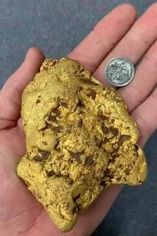
Large Nugget Detected in North Queensland
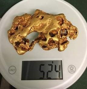
It was reported in 2017 that a prospector, using a Minelab Pulse-Induction (PI) detector, found a 1.17kg (37.7 Ounce) gold nugget in a field near Charters Towers. The nugget was 15cm (6 inches) below the ground. The prospector stated:
“It was beneath some vegetation so it was a bit of a challenge to get to, but now I’m thinking maybe those roots are keeping some other big nuggets safe ready to be found another time.”